Weather Alert for Saturday (December 9, 2023)
Here is an update from the National Weather Service in Huntsville regarding the severe weather threat for this afternoon/evening.
The entire Huntsville Utilities service area has been placed under a "slight risk" (level 2 of 5) for severe weather.
The timing window for the heaviest portion of the storm for Huntsville and Madison County is 7pm - 10pm.
A line of strong to severe thunderstorms is forecast late this afternoon and tonight across the Tennessee Valley. Discrete supercells will be possible ahead of the main line. The main threats with these thunderstorms are damaging wind gusts (medium confidence), hail (low confidence), and a few tornadoes (low confidence). The tornado threat will be maximized with any supercells that form ahead of the main line of storms.
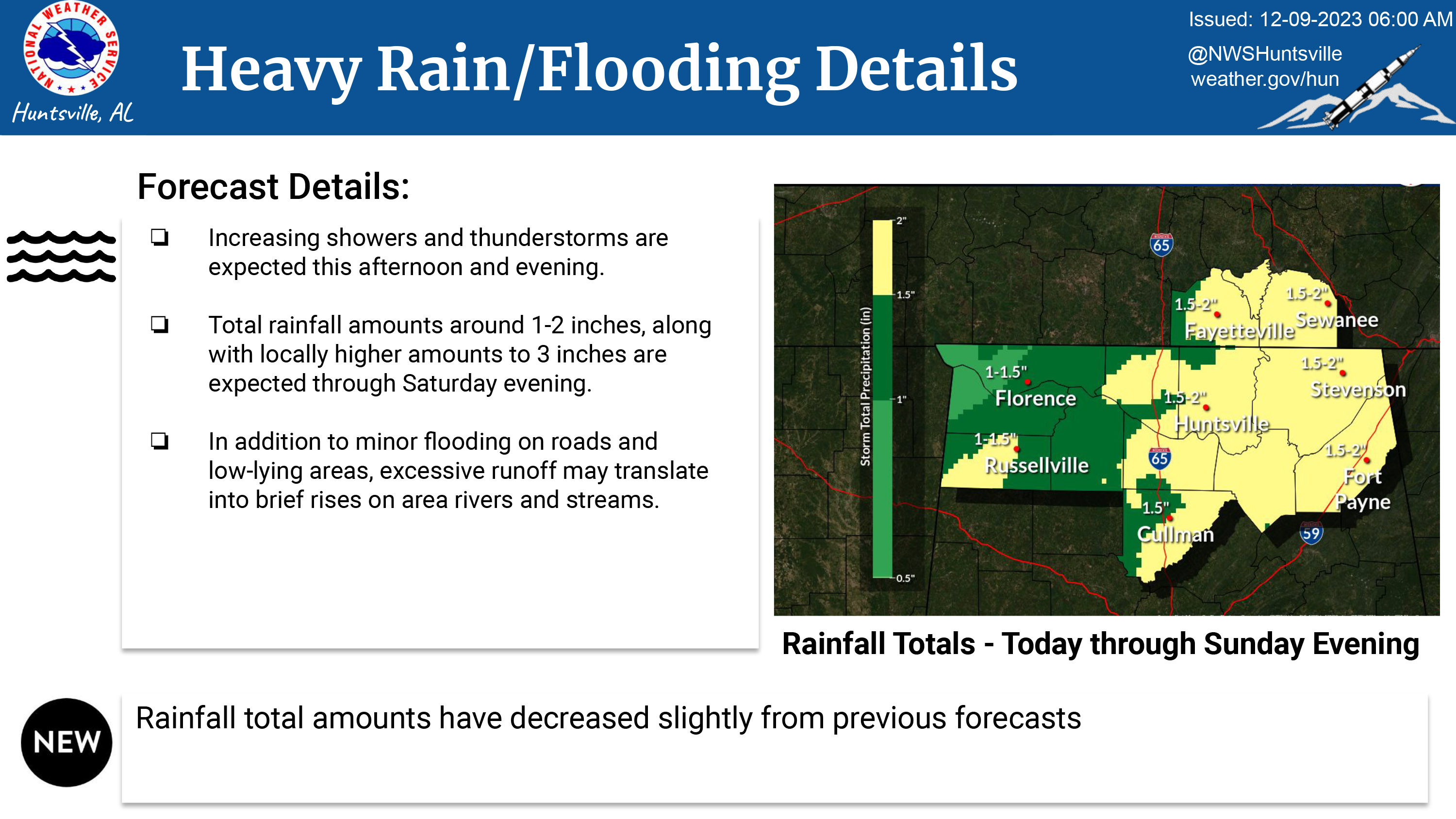
Increasing showers and thunderstorms are expected this afternoon and evening. Total rainfall amounts around 1-2 inches, along with locally higher amounts to 3 inches are expected through Saturday evening. In addition to minor flooding on roads and low-lying areas, excessive runoff may translate into brief rises on area rivers and streams.
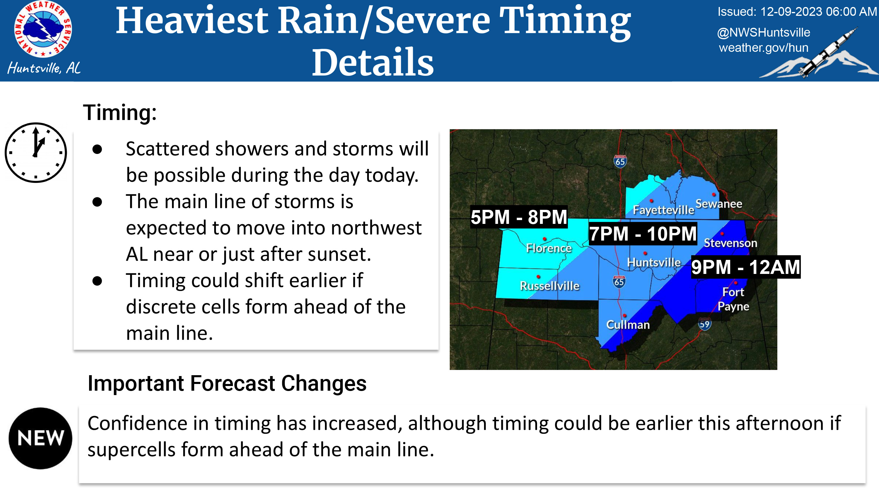
Scattered showers and storms will be possible during the day today. The main line of storms is expected to move into northwest AL near or just after sunset. Timing could shift earlier if discrete cells form ahead of the main line.
If you see a downed or obstructed power line, do not approach it, do not drive over it, and do not attempt to remove the obstruction. Stay far away and call us at 256-53-LIGHT (256-535-4448). This is also the number to call to report a power outage.
We are closely monitoring the weather situation and have crews standing by to respond to any service issues. Customers are advised to monitor local media and the National Weather Service website (www.weather.gov/hun) for update throughout the day.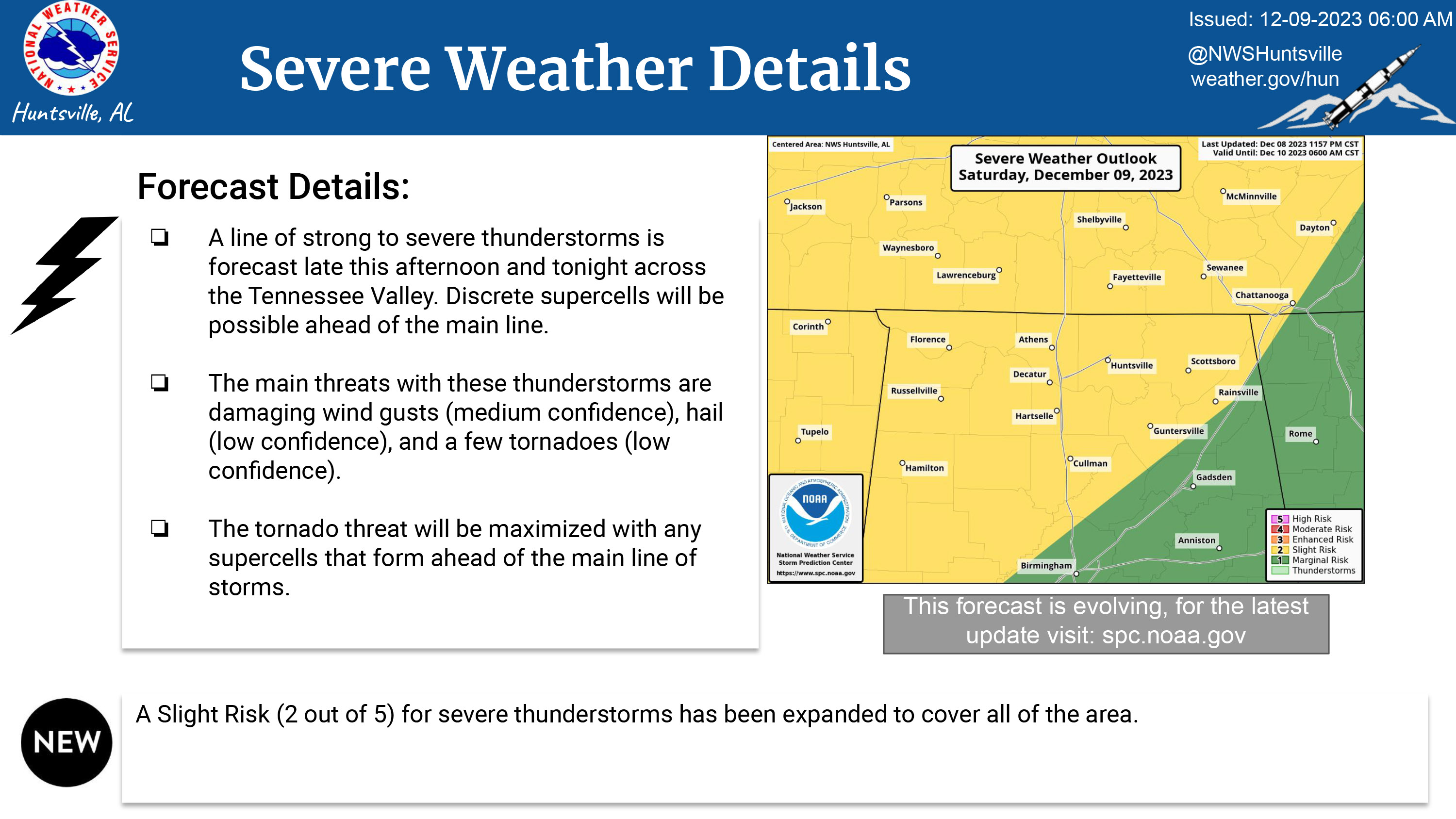
End of Update.
UPDATE (1:30pm Friday): The National Weather Service has issued an update. The main change is that the timing window for Huntsville/Madison County is now 8pm - 10pm.
#####
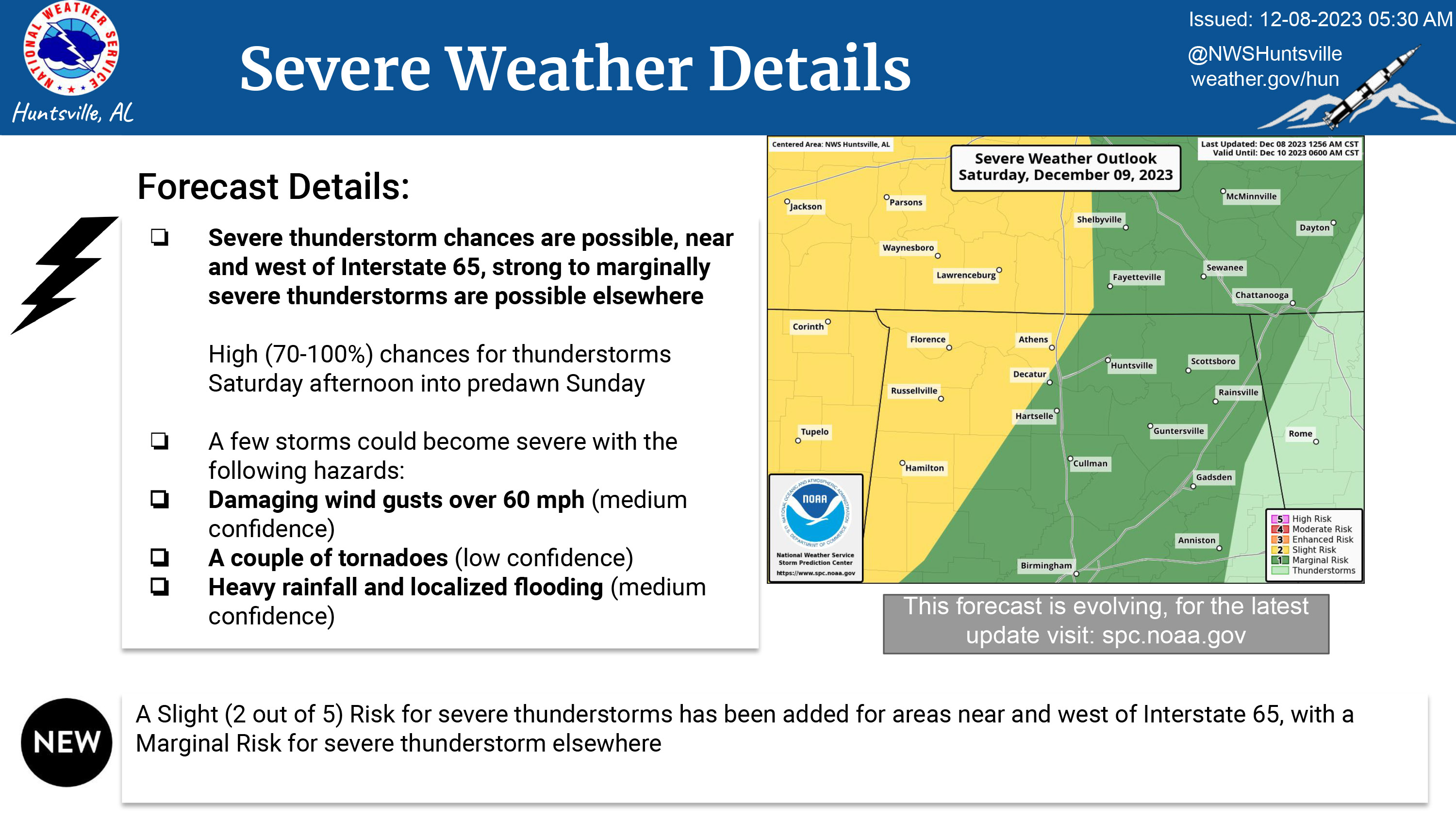
The National Weather Service in Huntsville is forecasting severe weather for our area on Saturday, December 9, 2023.
Severe thunderstorm chances are possible near and west of I-65, strong to marginally severe thunderstorms are possible elsewhere.
High (70-100%) chances for thunderstorms Saturday afternoon into predawn Sunday.
A few storms could become severe with the following hazards:
--Damaging wind gusts over 60mph (medium confidence)
--A couple of tornadoes (low confidence)
--Heavy rainfall and localized flooding (medium confidence)
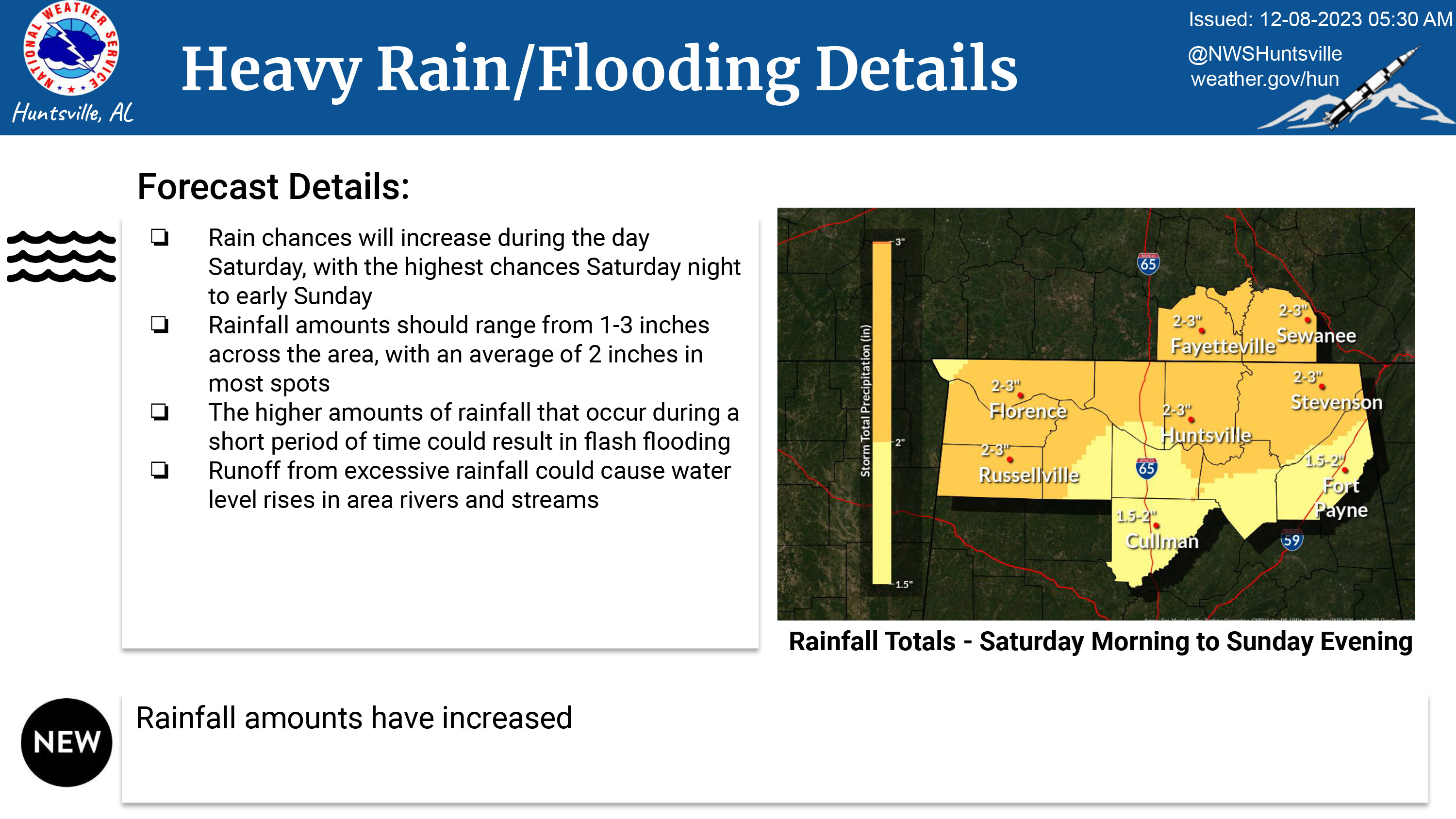
Rain chances will increase during the day Saturday, with the highest chances Saturday night to early Sunday.
Rainfall amounts should range from 1-3 inches across the area with an average of two inches in most spots.
The higher amounts of rainfall that occur during a short period of time could result in flash flooding.
Runoff from excessive rainfall could cause water level rises in area rivers and streams.
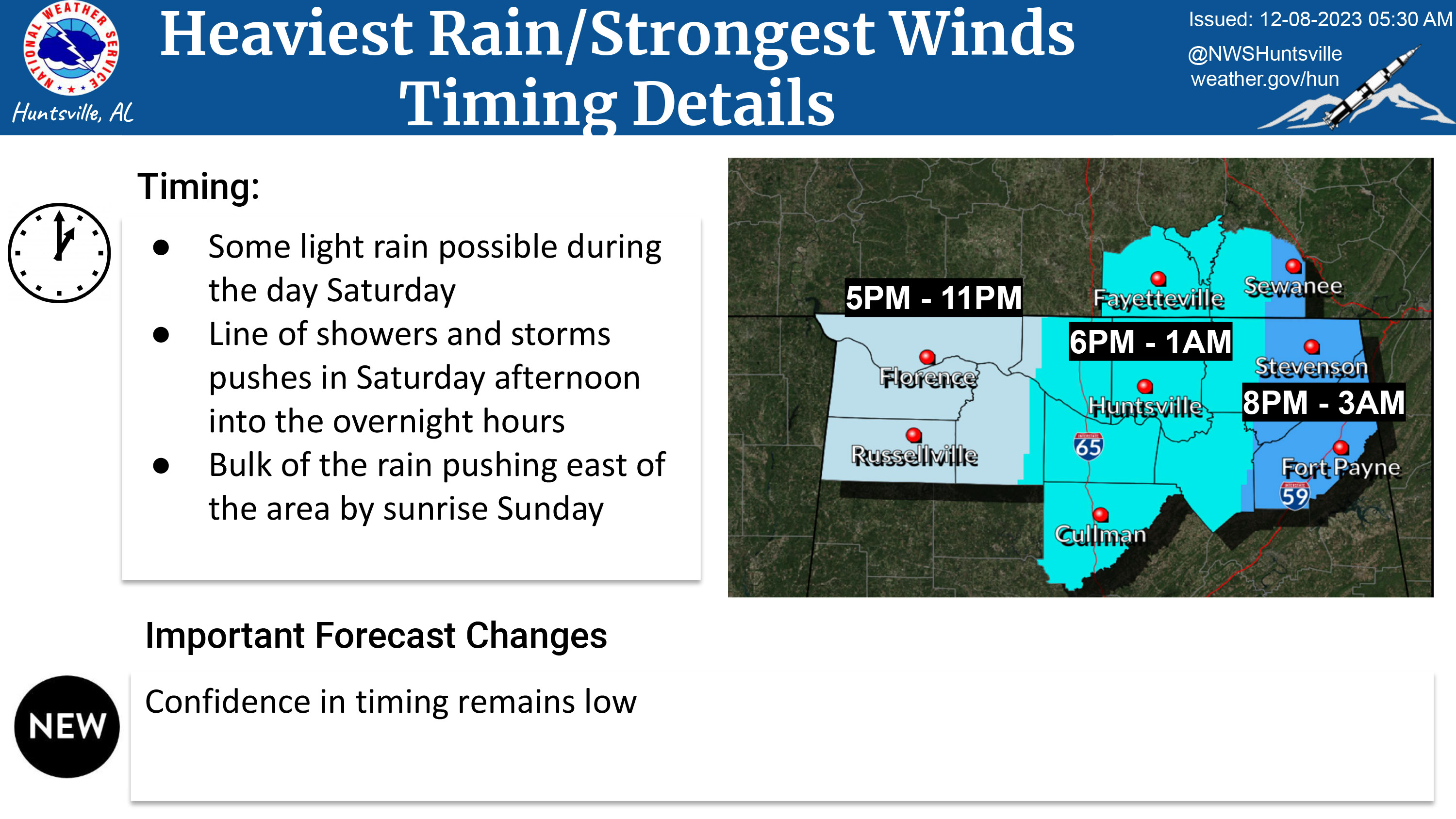
Some light rain possible during the day Saturday.
Line of showers and storms pushes in Saturday afternoon into the overnight hours.
Bulk of the rain pushing east of the area by sunrise Sunday.
For the Huntsville/Madison County area, the timing window for the heaviest rain and strongest winds is 6pm - 1am
If you see a downed or obstructed power line, do not approach it or attempt to drive over it, and do not attempt to clear any obstruction. Call us immediately at 256-53-LIGHT (256-535-4448) and stay as far away from the line as you can, since wet ground allows electricity to travel farther.
The number above is also the number to call to report a power outage.
We are closely monitoring the weather situation and have crews ready to respond. Customers are advised to monitor local media and the National Weather Service website (www.weather.gov/hun) for updated information.